I just came from a 10 day long trip and I’m feeling quite happy about it! Usually it’s the new place, new experience that’s major booster for post-trip happiness but not in this one. I backpacked solo after almost an year and had my camera with me, not just in the bag, but around my neck! and I felt connected with my old self. Well, it does sound cliched, but that’s how I feel after my trip where I trekked through Hampta pass from Kullu Valley to Spiti Valley and then spent a couple of days at the villages in the valley. Why this trip was good for me? Because I was doing a few things for the first time such as camping in a glacier bed and then there were things which I used to love but hadn’t done in a while, stitching panoramas for creating a photo-story of my trip.
It was a pleasant surprise that though I hadn’t had the chance to work on my photography in last couple of years but now when this trip allowed me the chance, I was able to produce good results like the old days. It got easier after a few shots and I felt the compositions, aperture and shutter speed combinations coming back. Since I’m all excited about writing this travelogue, I even spent last 10 minutes in figuring out the right instrumental playlist that should go on while I write it out, I’ve decided to split it into 2 parts – the trek and the roadtrip..
So, moving over to the trek, Hampta Pass is still one of the popular Himalayan treks that a lot of interested folks would know about. If you haven’t done any trek before and are simply googling for “Himalayan Treks”, this trek is probably going to feature in 8 of the 10 links you’d see in the results page. I would recommend it as a perfect introductory high altitude trek, taking my personal threshold for high altitude as 4000m. Call it fresh spark of interest, but I did spend a few days reading about the other high altitude passes that a non-pro trekker can scale in India and a bunch of new groups that have come up recently to address the increased demand, and plan to do a post on this separately.
The tricky part of these treks is the timing, the same trek can vary in its difficulty levels depending on the season and how many people have crossed the pass before you. The earlier you go in the season, the fewer the crossings would be, the fresher the trails and harder the journey as you might be cutting through the snow slopes at some points. We crossed the pass on 22nd June 2017 and probably 50-100 others would have crossed it before us. It is always recommended to research this information about any potential treks you will be on, I got my information from EffortlessOutdoors.com, and planned accordingly. Thus in terms of the gradient of difficulty that the trek offers, I’d rate it at 7/10.. 10 for the first person who would have crossed the pass in May last week and rating 1 for the person who’d cross it in September last week after a couple of thousand people would have crossed it already.
I had done a few single day hikes before this and had been to 3000+ m elevation before, so I was not a complete newbie. But if you haven’t had any experience with such treks, I’d recommend some of the easier options to get yourself started. Nilgiris offer really good hikes through dense forests, I’ve hiked a couple of peaks at Coorg – Thadiandamol and Nishani Motte. There are number of similar hike options in Sayadari as well, thus Bangalore and Mumbai have a good community of hikers apart from Delhi. Finally from Delhi, you can go for easier treks such as Triund, Prashar Lake, Nag Tibba, Hanuman Chatti, etc. Just close to Manali is Bhrigu lake and that too is a popular trekking route that’s somewhere between the easy ones I mentioned and the Hampta Pass trek.
A lot of the groups you’d join would have people who wouldn’t have prepared for the trip and would then return mid-way. Most of the groups you’d be joining would also recommend you to get your body in an active mode 2-3 weeks before the trek. I personally did commit to a fitness routine, and I saw people who didn’t either struggling or returning mid because they got too tired too soon. It is easy to bypass the training and there are chances that you might still be able to finish the trek, but if you do find it tough in middle of the trek, then it is not just your problem, it becomes a problem for the other group members as well. It does take a bit of an effort to reach to views like below
Alright, let me now walk you through the trek, don’t want to make this a 1 hr read as well..
I had booked the trek through an online trekking group – MountainMonks, but later figured that their group was formed only through a partnership with another group that was being led by a local guide, who went by the name Ronnie. I was initially a little hesitant as the last time I had come for a bike tour of Spiti Valley, I didn’t like the planning of the trip as there too we didn’t have a big enough group and our organizer had decided to join with another group. I ultimately did not continue that trip and returned from Rohtang Pass. I didn’t want this trip to end up similarly. I had already cancelled a trip to Hampta Pass because the pass wasn’t yet open due to the heavy snow we had last year. So, this was really my last chance, if this trip wouldn’t have happened, I would have not tried a 4th time!
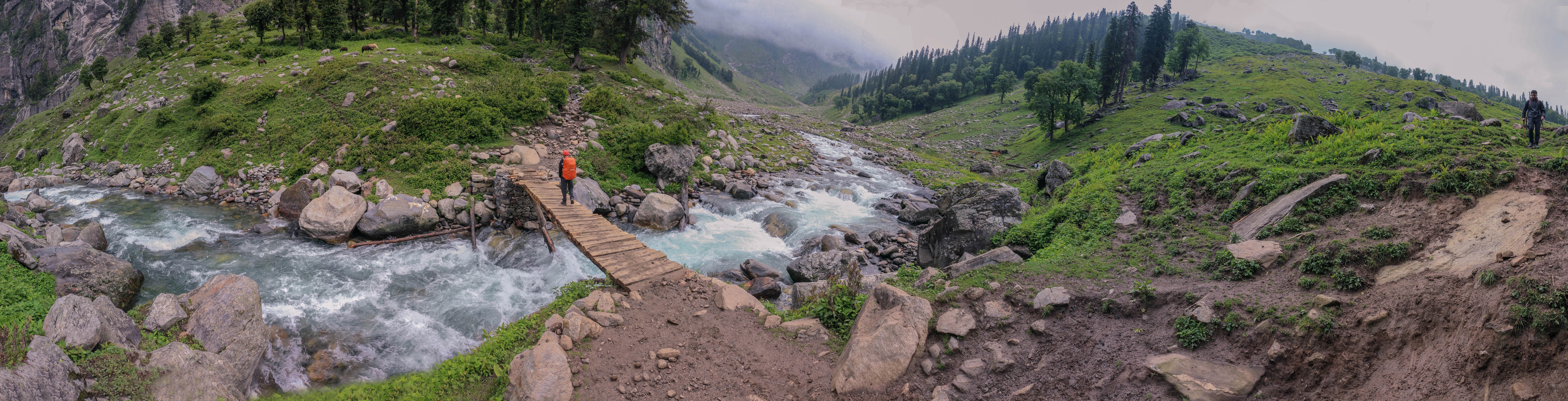
But nothing of this sort happened, after spending a day at Manali to acclaimatise and get well-rested, the journey started! The trek usually starts from Prini Village, and if you’re joining a group, drive to the village from the main city center is usually part of the package. But we then learnt that the trail only starts from Jobra, and a road has been laid down from Prini village till Jobra. But not all vehicles get the permission to drive on that road, thus depending on your group’s status, preference of the members and the authority’s stance, you’d start walking from Prini or from Jobra. There is a hydro-electric plant based on the river stream in vicinity that is really the cause of these driving restrictions.
There was a small bridge over a Rani nalla, a gushing glacier stream, that for me was symbolic of the start of the trek for us.

We had a small hike planned for the day as we were joining another group which would’ve started after a couple of hours after our departure from Manali and thus wanted to cover only as much distance as they could’ve covered before it gets dark. We had already lost phone signals by now and the only signs of settlement were the shop tents that we used to pass. Crossing one such shop in the pic below –
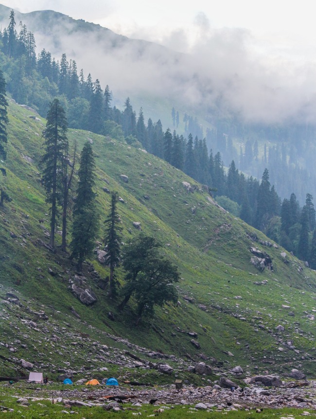
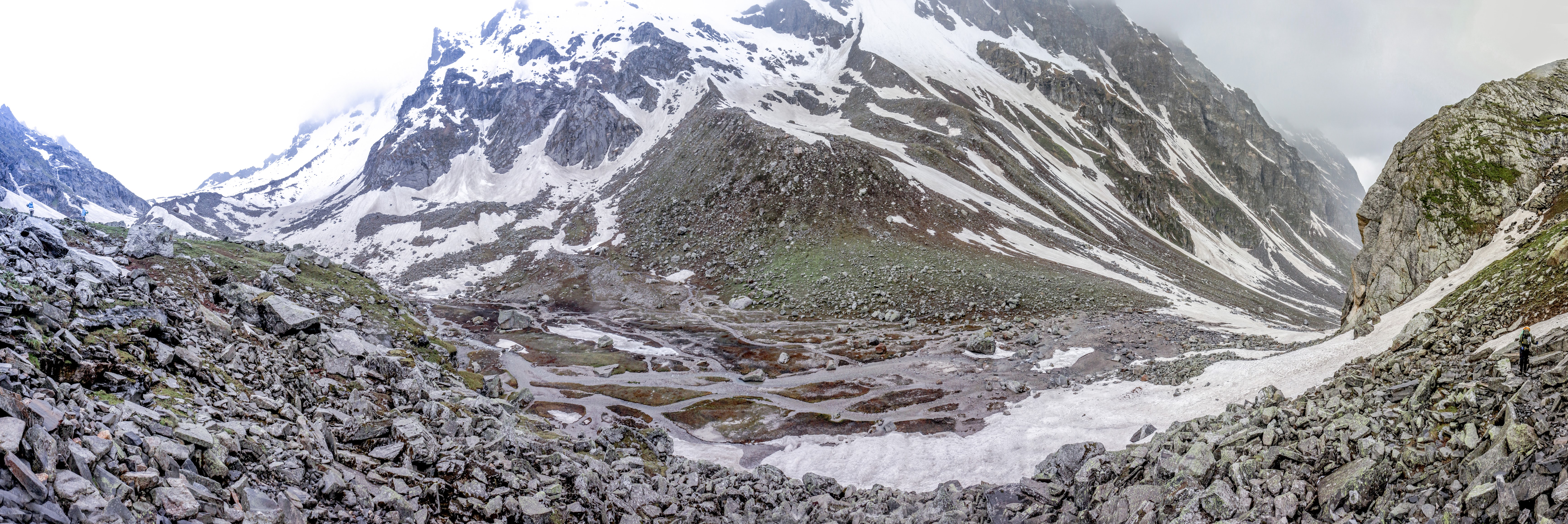
The plan earlier was to camp at Chika, a popular spot which even has some tents camped throughout the season. But we ended up camping a little before besides the river stream, which in hindsight was a good call as when we passed Chika the next day, I liked that spot better than where the tents are usually pitched. It also was a good spot for getting some good landscape shots, here are some –
The only other tent we could see at the spot was that of a shepherd whose flock was grazing on the central below, with smoke rising up from the tent of the shepherds –
Our tents too are visible in the pic above, just right of the shepherd’s tent but a bit distant. The pic below will give you a better idea of where we were if you can find the same trees as below in the pic above!
Soon, we had another group pitching tent close to us and in no time, they started preparing dinner. The smoke below in the pic is their kitchen firewood. 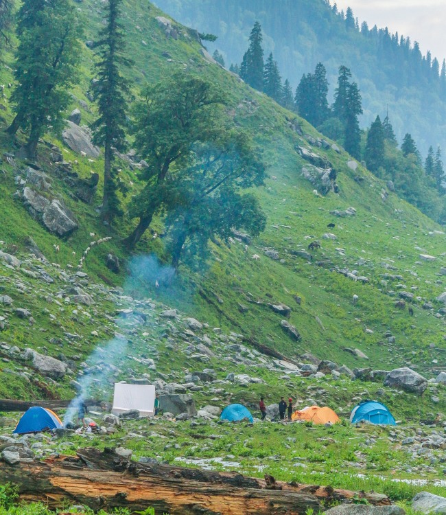
We learnt that the group wasn’t any usual group. It was just a lone crazy Canadian who was trekking along with 2 Nepali sherpas. They were attempting to cross the Hampta pass just like us, but it wasn’t even close to where they were ending their trek! They planned to keep walking till Chandratal from where the trek ends and then attempt to cross the Baralachala Pass to exit on the Manali-Leh highway and then probably walk till Leh! That’s one crazy plan! You can locate Hampta pass at the bottom and Baralachala at the top of the map below.
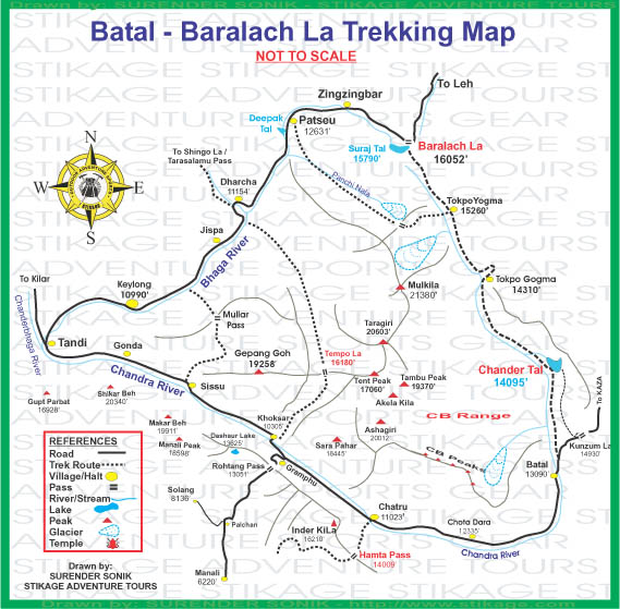
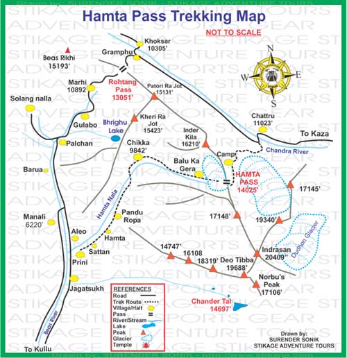
Zooming in on Hampta Pass, our first camp would’ve been just before Chika, before the Hampta Nala (or Rani Nala as it is alternatively called) begins to turn rightwards. The 2 yellow spots beyond Chika would be our other 2 camping spots – Balu ka Gera before the pass and Shea Goru beyond it. The trek ends at Chattru, beyond which the journey becomes a road-trip and I’ll cover that in the next post.
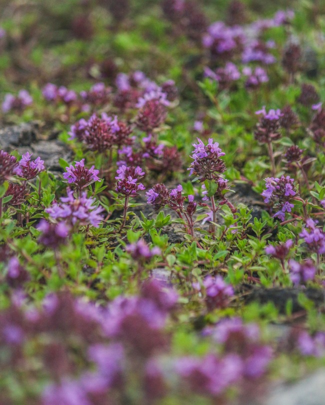
The campsite was nestled between a gentle hill, that you earlier saw from the shepherd’s perspective and a big steep rocky mountain with a river stream flowing between them. The terrain had a steep gradient in terms of vegetation. I distinctively remember the bright pink and yellow flowers close to the stream.
Take a guess what would have formed the background for my pic below.. It was a fallen tree! The tree trunk was breaking down into chunks and decomposing!
We must have reached the camp site by 4pm, so had enough time to capture these shots. There wasn’t much of a sunset, just a few golden minutes..
Here is another view of our tents with river stream in the frame as well..
We then closed the first day post dinner and fire-side chat with the new set of people everyone was with. Usual chat to get to know each other and build some rapport. The days are simple in mountains, there isn’t much of an agenda beyond sunset. The group gets to have dinner around sunset and then because this was still the first day, people weren’t tired, otherwise everyone sleeps off by 8pm to get as much as rest as possible.
I woke up in between 5-6 AM next morning but since we only were planning to march ahead by 9 AM, I had a couple of hours to kill. So, I decided to walk upto the shepherds whose sheeps were all packed close to their tent. I got some good close-up shots of there and I learnt event the shepherds were going till Chandratal, although at a much slower pace to allow their flock to keep grazing on the grass on the way.


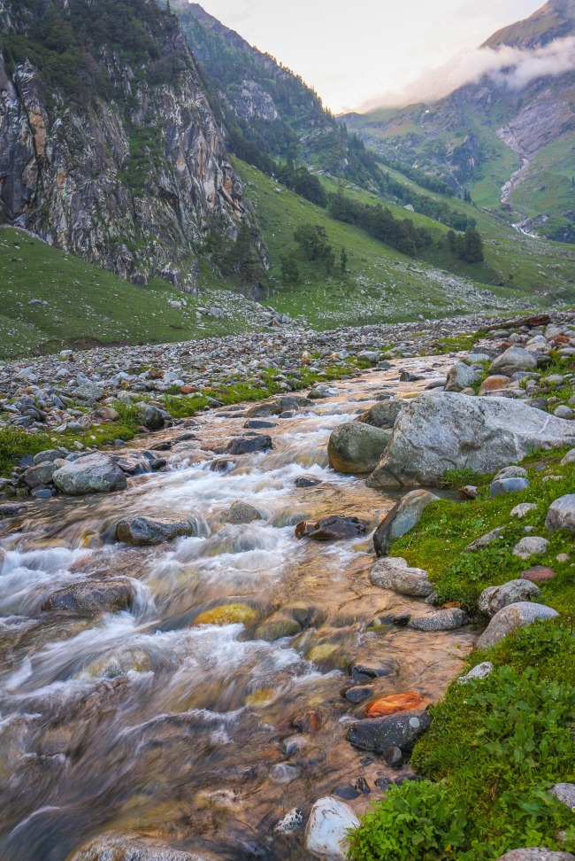
Much like the previous day, our trek today started with crossing a river stream and we then kept walking uphill, to its source, never leaving its banks out of our sights.
But as you can probably realize from the photo as well, it wasn’t really sunny for 9 AM. Infact we would have barely walked for 30 mins, and it started to drizzle which only got heavier as we walked up the hills. We were soon completely drenched as I realized that my rainproof jacket and lower weren’t adequate for the overbearing rain pouring over us! Not sure sure if it was because of the rain, but our group had almost split in 2 groups – few of us were much ahead than the rest of the group. We were trekking with Sanju from the trekking team and the trek leader was accompanying the rest of the group since they were 7 of them, while we were just a group of 2. There was no time to take out the camera there and we just kept walking, climbing up the boulders and at times had to cross a few waterfalls.
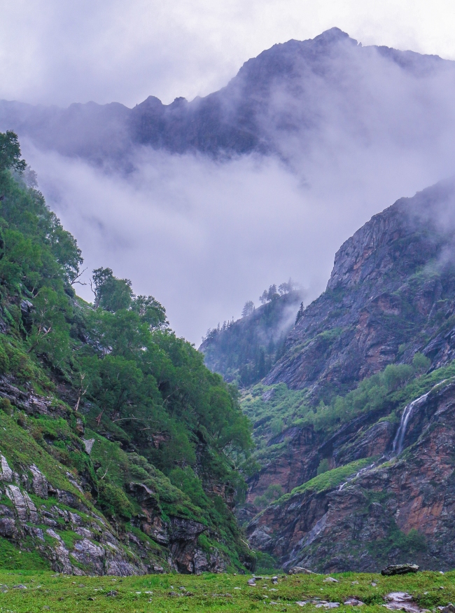
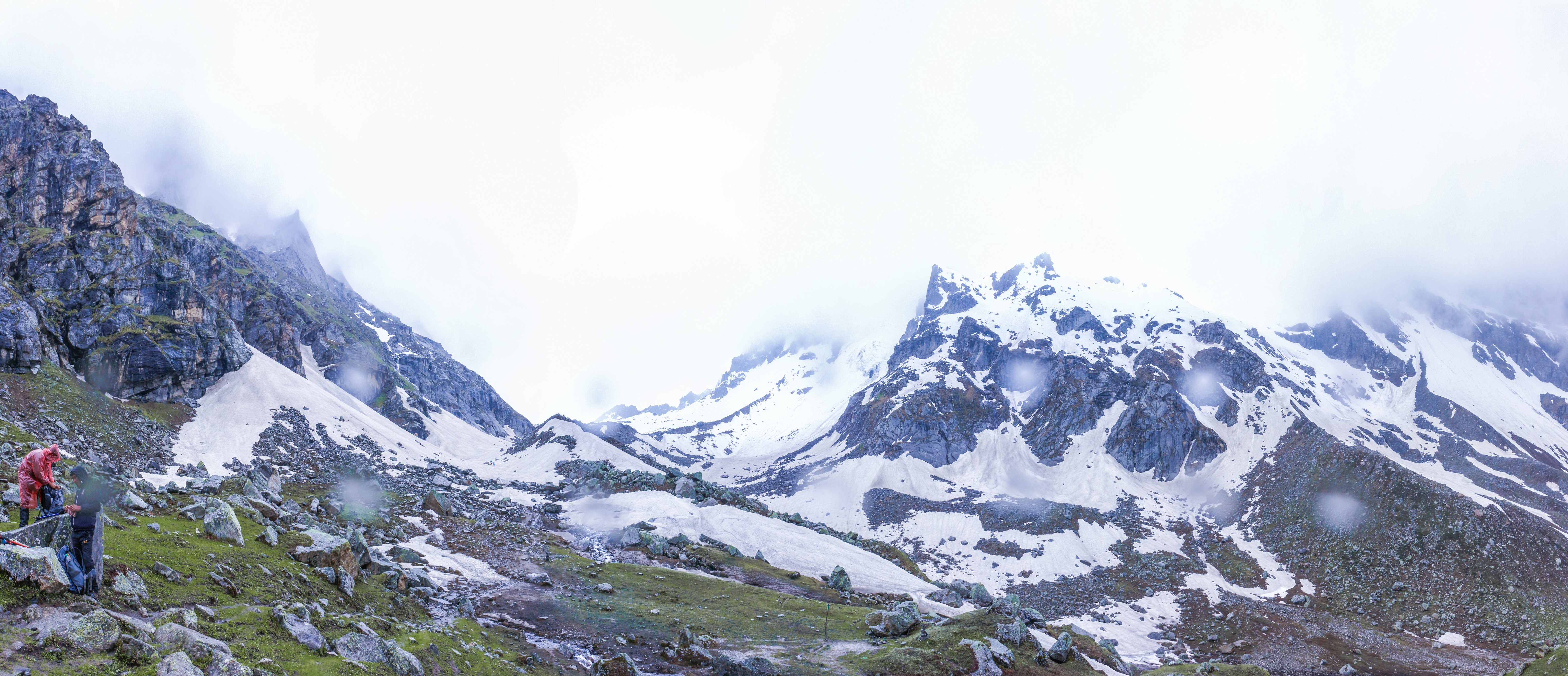
We walked in the downpour for about 3 hours and the much needed relief we got was when we reached Jwara where a small tea shop had pitched a permanent tent. We decided to wait out for the rest of the group there. The host was really gracious and served everyone hot tea and biscuits. He even let everyone warm up near the kerosene stove. It was noon by now and for a brief moment, the rain had stopped as it was really windy up here, compared with where were 3 hours ago. The landscape had changed as well, no more plants, only grass cover. We could even see patches of snow alongside the trail.
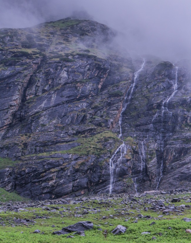
The trail ahead of us brought us to another stream that we had to cross. We kept hearing about this nallah the previous day that we had to cross before noon as the waterflow rises post noon. We reached the spot around 1pm, not too bad considering we had hiked in excessive rain all this while. There was no bridge over this stream, we had to cross it by foot and it’s hard to come up with words to describe the sensation you’d feel in your feet once you’re out of it from the other end. Imagine it to be like getting bitten by a thousand red ants but all you can do it wait for the sensation to get over! And it does get better only in matter of minutes, so nothing deadly. Our porters seemed so indifferent to their feet, so, I too decided to quickly tie back my shoes and get restarted. The views on the way didn’t disappoint, so we kept moving forward without any loss in enthusiasm.
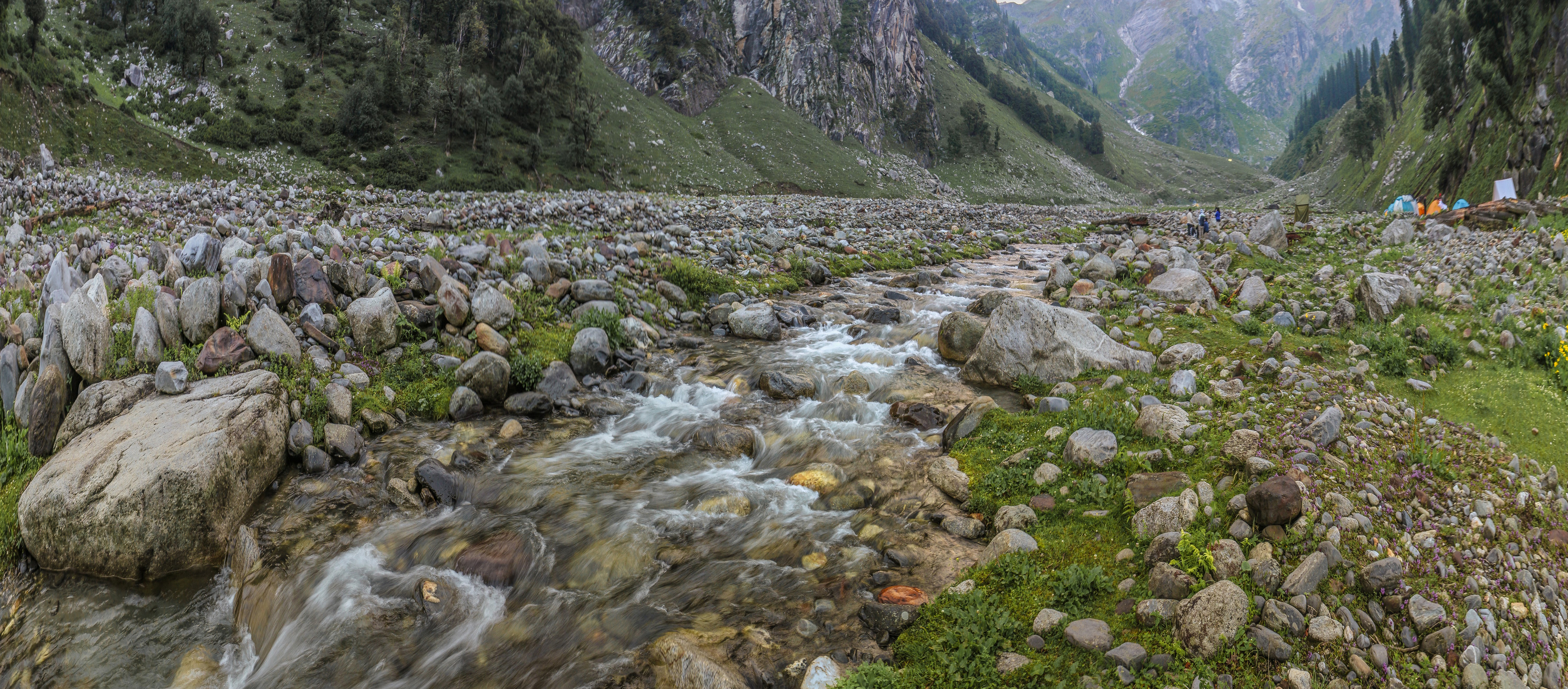
The landscape kept changing as we moved further, as you’d expect. It wasn”t surprising anymore to see small waterfalls emerging out the mountains. It was still raining but it seemed safe to get the camera out.
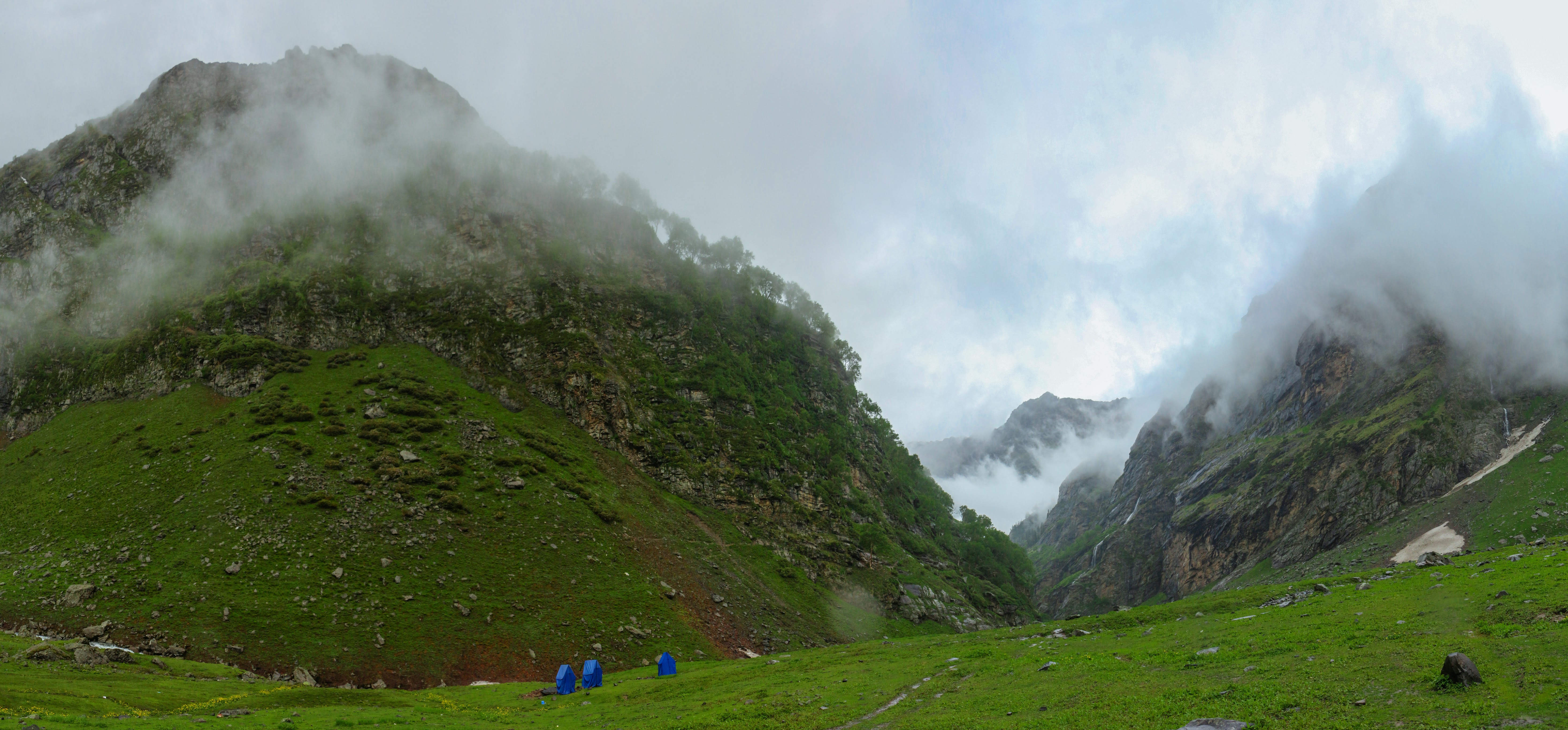
We kept moving further and the gap between the groups emerged again and it was apparent by now that we two were just walked faster than the other group. Thus, most of the times you’d be walking quitely on these treks, not really chatting and laughing like you’d in a city walk. We had reached our campsite for the day, Balu ka Gera, by around 5 PM and you can notice the difference in the topography of the 2 campsites, as we gained 900+m elevation.
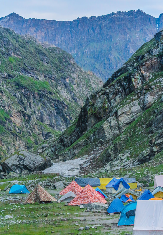
I had the heart and will to help setup the camps yesterday but I was just watching from sidelines today as the porters sprung into action soon after they reached the campsite and by the time others arrived, all the camps were up. It was also pretty windy up at the campsite, so we were feeling really cold in our wet clothes, but as soon as we got into the dry ones, we were feeling much better. The rest of the day went by quickly. Our trek leader had promised us that he’d be cooking Shakshuka for dinner. It’s an Israeli, or rather middle-eastern dish that he had learnt as he had led numerous Israeli groups over similar treks in the past. Everyone loved the dish, and the pasta was a bonus that really made the day for us! We couldn’t have asked for better hospitality at that spot! The white tent in the bottom right corner was the kitchen tent and the next few tents were ours. We had company for the day as few other trekkers had pitched their tents at the same spot, including the crazy Canadian!
Similar to the previous day, I got up a bit early as compared with others and had some time to explore and scout for good vantage points for morning sunrise shots.
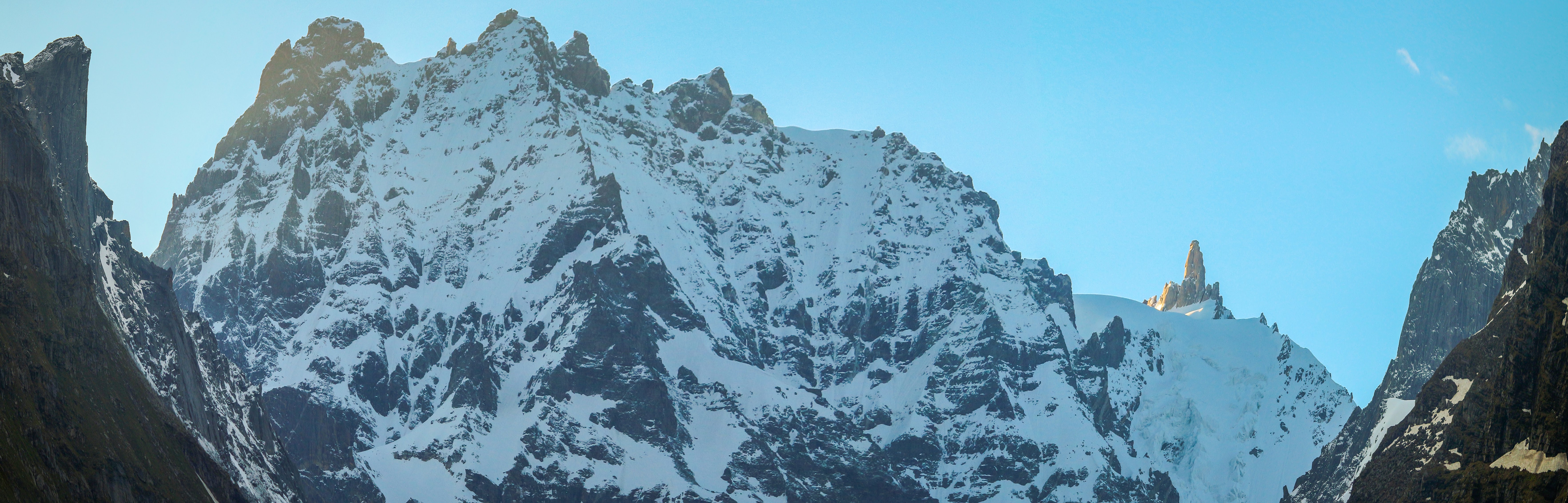
The one thing that intrigued me in the peaks that were visible from the campsite was a particular setup of stones on the top, visible in the photo above as well, which resembled a temple. Interestingly it was also the first one to shine as sun rose above the horizon. It seemed hard to believe all this was just a coincidence!
Soon, it was time for us to get started for the day, we got some really bright sunlight in the morning and it had reached our tents by 7 AM. Everyone took this opportunity to dry off the clothes that had got wet in rain. It’s hard to predict weather up there and soon the sunlight was gone as made way forward and the landscape again started to change. We had now reached a point where the green grasslands were transitioning into dry mountains which seemed to have a snow cover round the year.
But that also meant that it was getting harder to climb further. Although we were facing some troubles in keeping pace yesterday, which we had assumed was because of the rain, the delay today wasn’t looking very encouraging. We had to cross the pass today and we would soon be leaving behind rocky ground for glaciers. This transition was beyond the point of return and not everyone in the group seemed fit for it. Our trek lead Ronnie, pointing towards the pass below, switched gears and donned the tough guy hat, and took the hard call of suggesting the unfit members of the group to return back from this point.
Sanju, from the trekking team was tasked with the responsibility to lead the group that was returning back along with 2 other porters as we’d need fewer supplies now onwards. Our group was initially of 9, but only 4 of us continued from here onwards along with Ronnie and 2 other porters. It is to avoid situations like these, one must come prepared for such trips!
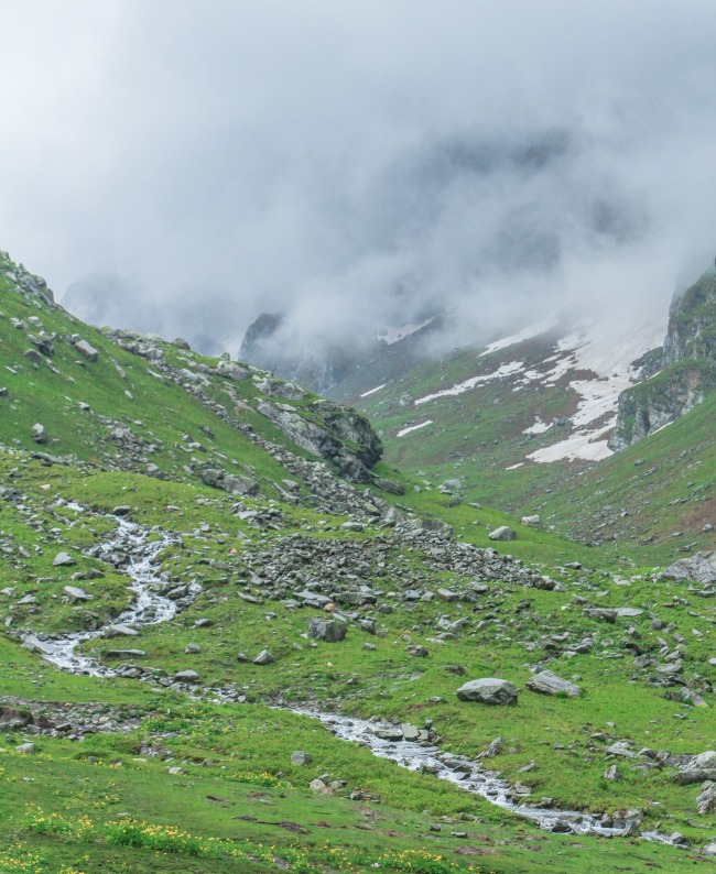
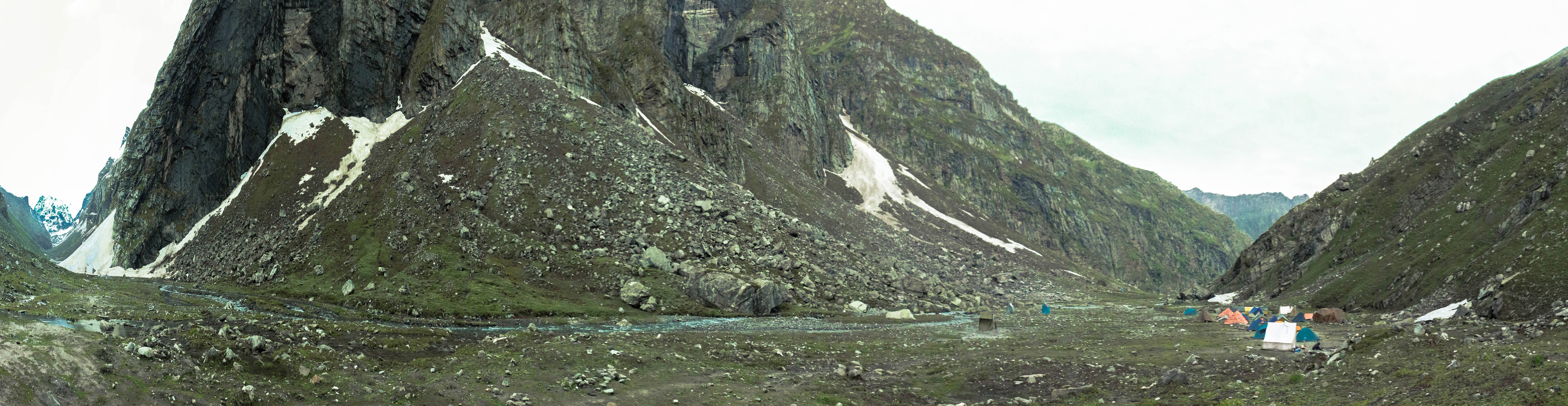
To make up for the lost time, we paced onwards and soon reached the precise spot for Balu ka Gera. Balu is a local word for sand and Gera represents a hill or a deposit in a way. Thus, the spot we reached was kinda glacial pool that out of nowhere had a sandy beach surrounding it. It wasn’t really an expansive lake, more like the glacial origin of the river stream that we’d be tracing upstream all this while, on a relatively flat stretch of land, thus the flow wasn’t as gushing as we had seen downhill previously. We had no interest in getting ourselves wet again so we navigated our way through the rocks on the slope of the mountain towards our left, with the river stream towards our right as in the photo below. The pass is visible as the bright snow patch just left of the big mountain in the center.
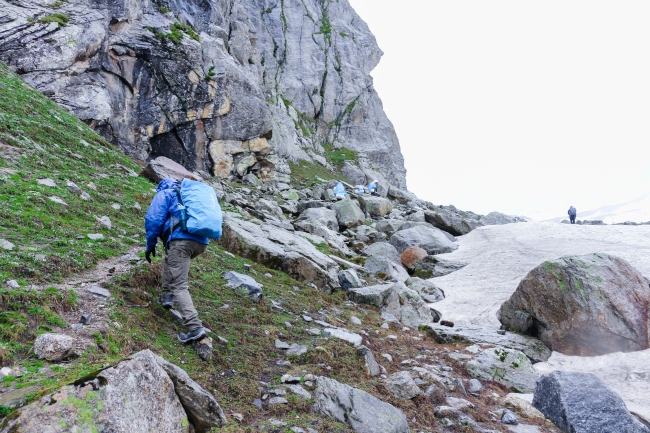
We kept moving forwards and soon reached the point where we had to start walking on the glacial snow, but instead of walking uphill, we were cutting through it, with the hill top on the left of us and the what was previously the river stream, and now seamed just thick layers of snow, towards the right.
I initially struggled to get a grip on the snow as I had never walked in such situation before but it isn’t as tough as I had imagined it to be. My biggest fear was that if I slip, I’d reach the bottom of the slope and there is even a chance that the sheet of snow cracks from my weight. So, I was walking with my concentration on just the next step and even though I didn’t fall but my best guess is that even if you do, you’d stop much before on the slope.
We had started with good weather but soon something unexpected happened, as we kept climbing, it started to snow! It initially started out as light drizzle but it soon converted into a mix of hail and snow. You can see folks bringing out their wet kits for the climb further.
This was also the transition point where we left the grasslands for snow patches and then soon after had to cover the rest of the trek over what seemed like a glacier because we were no longer walking at the edges! That’s me going for the climb and you can see Ronnie, towards the right edge, considerably ahead of me, comfortably walking over the snow patch!
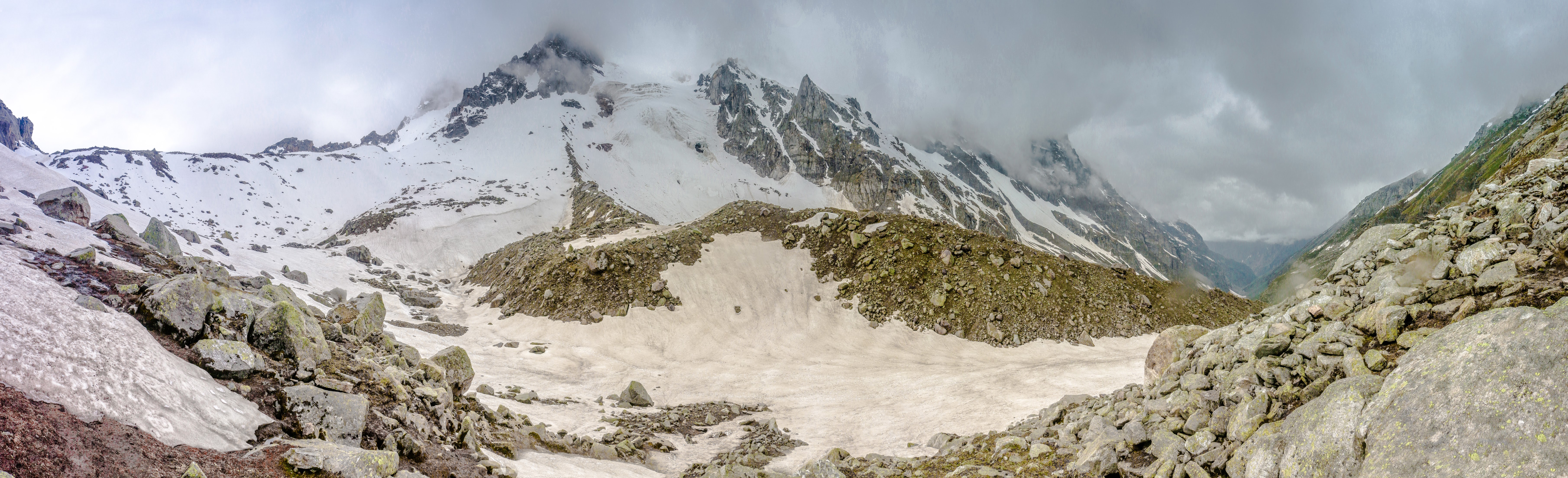
The way to the top can be divided into 3 glacial ridges, of which 1st is the shortest but since it’s the first you’d find it a bit tough, 2nd is the easiest but the longest and the 3rd one has the steepest climb but being in walking distance to the top, you’d never want to give up there! The photo below was clicked just after we finished the 2nd ridge. The pass is visible on the left as a stretch of relatively flat spread in between the 2 peaks.
I did well on the 2nd ridge and had gained some confidence thus marched forward towards the pass and soon enough we were on the top. All this while we were the only ones, we did not meet even a single soul after we had left the campsite at Balu ka Gera. The first person we met was on the top, a porter who carrying mules for another group which had just crossed the pass. He updated us that we might be the 5th or the 6th group to cross the pass! But later after returning and speaking with a guy who had crossed the pass on 13th June, I learnt that we might have been the 15th or so group. Many brave men had already done it in the week before we were there!
Below is the shot from the top of the pass! The shot was clicked from the saddle point, and though my description might sound so vanilla right now, but the quiet excitement and satisfaction of reaching the top is something special, be it anywhere!
We took a symbolic break and offloaded our bags at the top to celebrate the moment. Funfact is that the memory card that had shots of me in the frame got lost somewhere, so you’d have to just imagine on these trails! The range that you see in the bottom right is where we were headed. For us, this was the entrance to the Spiti Valley. Here is a first look of the valley clicked during our descent.
I learnt that the wide valley is actually a glacier and it was the biggest we had seen thus far! I further learnt that we’d be camping somewhere down there. We were a bit relieved to learn that the camping site was not as dry and glacial as we had imagined. We camped on the foot of the slope of the mountain you see below, the camps are visible in the pic when you’d zoom in the original. We had finally reached Shea Goru!
You already know by now what happens once we reach the camps – we eat and then talk for a while and go to sleep to get as much as rest we can for the upcoming day. The next day wasn’t as tough as it was all downhill till Chatrru and we were blessed with really bright sunshine, enough that I had changed to shorts and just a tshirt.
Spiti Valley was looking as I had imagined and the vast expanse of mountains turned darker in shades as we looked further. We must have reached Chattru by noon and met the jeeps which had come from Manali with the group members who had returned back the previous day. Not everyone was extending the trip to Spiti, so the group that was originally of 9 and had shortened to 4, now swelled to 6. We greeted and congratulated each other on the symbolic end of the trek.
Now when I am writing back about the trek, I can confidently say that I’d like to have Ronnie and his crew for my next trek as well. I personally really enjoyed his company and hospitality which would have been missing in the trek organized by bigger & more professional groups. I’d recommend you to check his availability whenever you’re planning a similar trek in the region. He is available at +91 8219826730
Chattru isn’t even a village, just a bunch of tents pitched closed to a bridge on the Chandra river. But it didn’t matter to us, we went ahead and ordered Rajma Chawal for our lunch at the Dhabha there, that was enough to bring a smile on our face! 🙂
The next half of the post will become the part 2, which I would post soon enough, I’d go edit some more photos till then! If you want to have a better look at the photos posted here, you should check out the full album. The 180 degree panoramas especially end up too small for the screen, but in the album you’d be able to zoom-in and you’d see much more details! Plus, the photos which aren’t here. Always happy to hear from you guys and if you’ve done this trek as well, do share your links in comments!
UPDATE – the part 2 of the post is now live – Spiti Valley – Road Trip to NoWhereLand

this is by far your best blogpost anu … loads of love